|
| |
Kanu Links

Grey Owl's Bisco Routes
Pogamasing River and
The Land Beyond
|
| Below the forks of the Spanish and to
the west, a large lake paralles the river for about 20kms: Pogamasing or Pog' Lake for
short. In the days before the railway, it played a key role on the travel up the river to
the Arctic Watershed because one could use it to bypass the many rapids of the West
Branch. In the late 1800's, Pog' Lake even had a Hudson's Bay post. Today, it is in the
recently created Spanish River Provincial Park and it is still in outstanding canoe
country.
About the topo map extracts on this page and their linked
enlargements:
©Her Majesty the Queen in Right of Canada
Reproduced with the permission of Natural Resources Canada |
 This
page describes the route from Sinaminda Lake into Pog' Lake in a west to east
direction as if one came from Biscotasing and wanted to reach the Spanish River
at Sheahan.
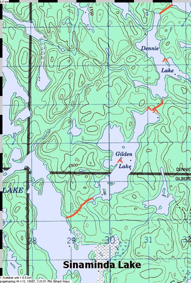
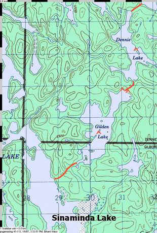
Starting from Sinaminda Lake, the portage to Gilden is
easily missed. For one, there are maps that have it drawn too far south and thus the
paddler searches in a bay rather than along the straight shore. The other unusual aspect
is that the shore there is rocky with a steep slope. Look for a somewhat open and sloped
space, and there may be a cached boat or two up the slope that would give it away. A
hundred feet further south is the start of the original portage, with three large blazes
on a pine but the trail is nearly overgrown there, so don't try there.
The portage - a bit less than 1000m - itself is well maintained, and nature
is intact as with all the portages along this route. Gilden is a pretty lake and so is
Dennie which follows after a medium length portage. |
|
 |
|
On Sinaminda Lake, the start of the portage to Gilden is at a spot that is
better suited as a motor boat landing |
|
|
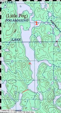
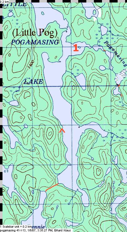
Little Pog' still has a witness to the logging of more than fifty years
ago: a capstan-like device can still be seen on the eastern shore, about half way up
towards the Pog' River. If the nice camp site on the western shore should be taken, you
could try the other one on the eastern shore in the north half of Little Pog' (off the
map). And if one is interested in exploring more back country routes, one can portage out
of the north end of this lake into lakes such as Little and Big Squaw, Bagpipe and even
Squirrel.
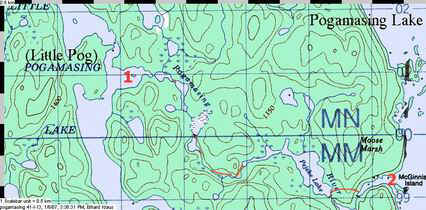
To continue on the route towards Pog' Lake, leave the lake
via the Pog' River where the "1" is on the map. |
|
An exploration out of the north end of Little Pog': a rainy spring day on
Big Squaw Lake (not directly on this route) |
|
 |
|

|
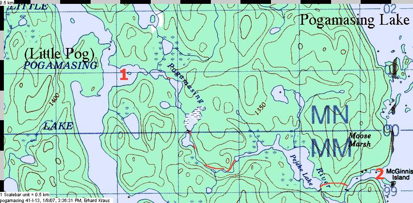
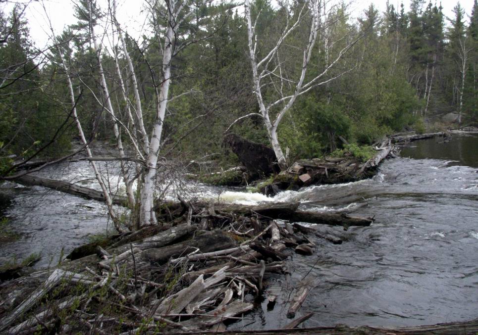
 During much of the year, the Pog River is more a creek, but it has sufficient water all
summer long. Follow the portages and be thankful to the folks of Pog' Lake that keep
the trails open. All portages are on the north side (left as you go down the river), and
once you found the start of each trail, it is easy to follow. I may not have drawn in all
the portages onto the map and you should allow for sufficient time to do this section. A
day (or at least half a day if you are well organized) is not too generous..
During much of the year, the Pog River is more a creek, but it has sufficient water all
summer long. Follow the portages and be thankful to the folks of Pog' Lake that keep
the trails open. All portages are on the north side (left as you go down the river), and
once you found the start of each trail, it is easy to follow. I may not have drawn in all
the portages onto the map and you should allow for sufficient time to do this section. A
day (or at least half a day if you are well organized) is not too generous.. |
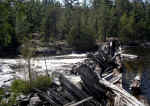 |
An old dam reminds of the days of traditional logging here. |
One of the lakes along the way: Pejeke Lake |
 |
 |
|
.. |
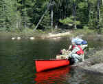
Not all landings are as simple as this one |
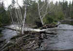
Pog River has plenty of water in spring |
 |
|
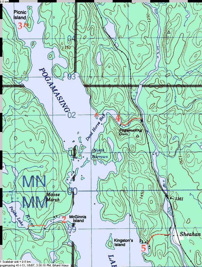
 The last portage, at Pog' Lake, is not in the corner of the deep bay but maybe 100m
to the east on the north shore. This is important to know if you come from the lake and
look for the portage.
The last portage, at Pog' Lake, is not in the corner of the deep bay but maybe 100m
to the east on the north shore. This is important to know if you come from the lake and
look for the portage.
On Pog' Lake, waves can be big once you leave the shelter of
the bay (at "2" on the map) - so it's wise to have a spare day. If you get stuck
during the day, try a crossing at night when the winds typically die down. Generous
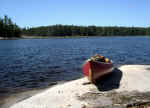
camping is at Picnic Island (at "3") in the north end of the lake, but there is
also a less scenic site at Dead Horse Bay.
Camping there would give you quick access to the portage (at "4")
down to the Spanish. I personally prefer this portage but some folks find its steep
sections (just below the dam) a bit daunting and thus - especially if you carry a canoe
that's very heavy or longer than 16ft.
Maybe the other portage is a better choice for you. It starts
in the bay to the east of Kingston Island, site of the former Hudson's Bay post, and you'd
carry along the road that leads to the river crossing (at "5"). There, you
either paddle across the Spanish to board the train at Sheahan or you continue down the
river towards the Elbow or maybe even go all the way to Agnew Lake, the end point of
the Spanish River route. |
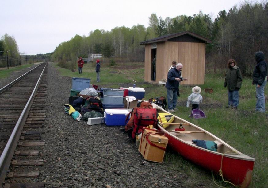
| The railway at Sheahan. It serves both canoe trippers and the camps
(cottages) on Pog Lake. |
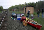 |
Check the schedule and reserve - the train runs on alternate day schedules
|
 |
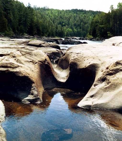
If instead you decide to trip all the way down the Spanish, you would pass
the Graveyard Rapids |
|
|
|
|
|
|
|
Pogamasing Lake gives the adventurous paddler access
to several back country routes. The above route takes you towards the west to
Sinaminda Lake. From there, one can continue to Biscotasing, either via the large Mozhabong and Indian Lakes, or over a route up the small Sinaminda Creek and Mishap Creek to Houghton
Lake and Biscotasing.
But one could also head south through some beautiful lakes and creeks
and rejoin the Spanish river downstream at the Mogo River. The Spanish River Sidetrip documents
this particular route. |
|
Home Back to
Erhard's Home Page
Click here to get to Erhard's
Favorite Paddling Areas
|