At the Bariloche Tourist Information, I have joined two cyclists, Marianne and Werner. He's an athletic type who's cycled all over Europe, even the Carretera Austral, four years ago. He "eats long distance for breakfast, lunch and dinner" and had once pushed 200 km per day on the Carretera. Not so tough is Marianne; she is happy to be with him and on previous vacations has joined him cycling in Norway and Majorca. On this trip, she carries only about 30 pounds of gear in two rear panniers while Werner lugs 90 lbs. in towering packs. Not to miss a beat, he's added four one-liter-bottles of red wine to the food for the next few days. We three all want to take the "boat route" to Chile and decide to travel together. There is detailed advice from the Tourist Information office in Bariloche: the boat will leave at 10:00 the following morning from Llao Llao, a village about 20 km west of Bariloche, and tickets should be bought in advance to guarantee a seat. So, we visit a travel agency to get the tickets. We hear that a boat different from the usual one serves tomorrows run, and no one in the office knows whether they will take the bikes. But by 5:00 p.m. it's all sorted out and we have a booking as well as food for maybe two days. We decide not to stay in town but get as close as possible to Llao Llao so nothing unforeseen will interfere the next morning. The ride to Llao Llao is the busiest I have cycled so far: cars are constantly passing us on a road lined with houses, stores and driveways. We are glad to reach the country-like setting of our destination and obtain confirmation from some employees of the little port that the information about the boat is correct.
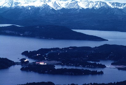 Llao Llao, with the
hotel Llao Llao as the brightest building near the bottom of the photo, and the boat
landing as the 2nd brightest spot just to its left . We camped illegally in one of the
dark spots....(photo from Pablo D. Zavattieri's Gallery )
Llao Llao, with the
hotel Llao Llao as the brightest building near the bottom of the photo, and the boat
landing as the 2nd brightest spot just to its left . We camped illegally in one of the
dark spots....(photo from Pablo D. Zavattieri's Gallery )
Where to stay overnight? There is this monstrous hotel on the hill overlooking lake and
golf course and, of course, it will be out of reach for our limited budgets. We ask locals
where there might be a suitable camp site and we are directed to a meadow near the boat
landing. On close inspection, we decide against it as there are glass shards and other
trash. Werner is really good at locating "alternatives": he does this all the
time in Europe, he says. He takes off into the dusk to scout and returns 15 minutes later,
all beaming with success. He's found a neat site amongst tall trees, away from the road
and just a little distance along an unused path, behind a breached fence. We pass a
peaceful night and, while brushing teeth in the morning, watch work crews from the golf
course pass our little hide-away no more than 100m away, without noticing us.
The next morning finds us on the sleek catamaran motoring towards Puerto
Blest, the end of this westward bay. The boat could go much faster, I suspect, but why
offer the tourists less than a 1-hour ride on this spectacular lake. The boat passes
the mausoleum of Perito Morenas, the Argentinean explorer, and the ship blows its whistle
in respect. Once arrived, we forgo the reasonably-priced meal, advertised by the big hotel
at the landing, so that we may race across the 3 km dirt road towards Lago Frias. There,
another, smaller boat waits to ferry us across Lago Frias. It's the only run today and we
can't afford to miss it. Lago Frias is emerald green, with vertical shores that prohibit
the building of any road along its shores.
The boat passes
the mausoleum of Perito Morenas, the Argentinean explorer, and the ship blows its whistle
in respect. Once arrived, we forgo the reasonably-priced meal, advertised by the big hotel
at the landing, so that we may race across the 3 km dirt road towards Lago Frias. There,
another, smaller boat waits to ferry us across Lago Frias. It's the only run today and we
can't afford to miss it. Lago Frias is emerald green, with vertical shores that prohibit
the building of any road along its shores. 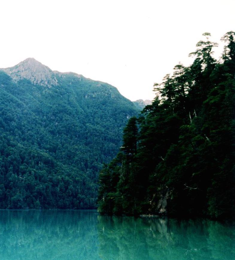 After a half hour jaunt, we are at the start of a steep dirt
road. It goes for 4 km up to reach the pass that marks the international border and then
down for about 20 km into Chile. It's the border personnel's day off as it's Sunday, but
the casually shirt-sleeved official processes our papers anyways. We are cleared to go on
and cross the mountains.
After a half hour jaunt, we are at the start of a steep dirt
road. It goes for 4 km up to reach the pass that marks the international border and then
down for about 20 km into Chile. It's the border personnel's day off as it's Sunday, but
the casually shirt-sleeved official processes our papers anyways. We are cleared to go on
and cross the mountains.
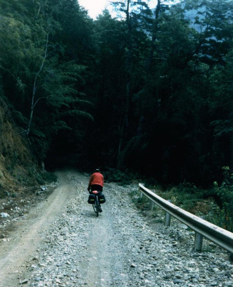
The road is much easier to deal with than we thought, at least the short
piece on the Argentinean side. We soon have pushed our bikes for about 3 km and make camp.
It's a nice spot, underneath big trees, between the road and a rushing creek. We want to
hike the trail that starts here. In the border checkpoint, we had seen it listed as one of
the hiking places nearby: I think it was called Sendero Rigi, and it was listed
as difficult. So, the three of us take off onto the little-used side trail, which soon
dips towards the creek and then runs up the creek bed itself. Marianne has had enough when
the trail demands clambering over and under fallen trees and she returns to the tents, but
Werner and I push on. Soon we are in a bamboo thicket (quila) that obscures the
trail. 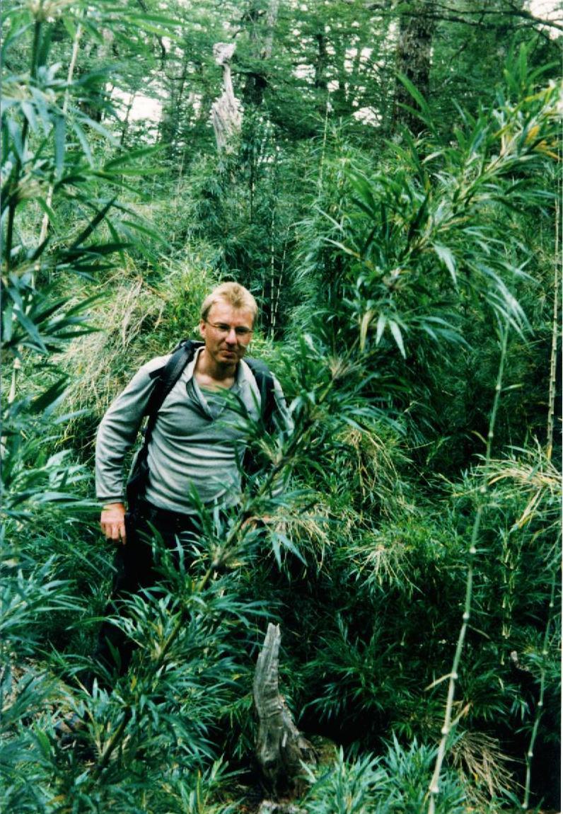 That's
probably the reason why the trail is marked difficult. I rely a lot on the feel of the
ground underneath; if it gets soft, I know I am off the trail. Fallen trees present a
special challenge: the trail will go right up onto the horizontal trunk to take advantage
of the level "bridge". But then it's not obvious where to get off the huge trunk
in order to continue on the path: all you see are dense tufts of green bamboo leaves and
there's no gap indicating a trail. Blazes on trees help, every 50 ft or so, and many
times, one of us stays at the last seen blaze while the other scrambles forward and tries
to pick up the trail again, calling unseen from 20 feet away: "this is not it!"
or "it ain't it either". Just the wiggle of the bamboo gives away the location
of the caller. The trees are tall, and moss hangs off the branches. As we get
higher, the bamboo thins out and there are now bushes with various flowers and berries.
That's
probably the reason why the trail is marked difficult. I rely a lot on the feel of the
ground underneath; if it gets soft, I know I am off the trail. Fallen trees present a
special challenge: the trail will go right up onto the horizontal trunk to take advantage
of the level "bridge". But then it's not obvious where to get off the huge trunk
in order to continue on the path: all you see are dense tufts of green bamboo leaves and
there's no gap indicating a trail. Blazes on trees help, every 50 ft or so, and many
times, one of us stays at the last seen blaze while the other scrambles forward and tries
to pick up the trail again, calling unseen from 20 feet away: "this is not it!"
or "it ain't it either". Just the wiggle of the bamboo gives away the location
of the caller. The trees are tall, and moss hangs off the branches. As we get
higher, the bamboo thins out and there are now bushes with various flowers and berries.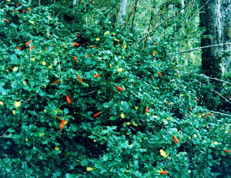 I
discover murta, a berry I had eaten in Puerto Montt as topping of cakes (kuchen),
an orange flower like a trumpet on a plant resembling holly, and some plant with bright
orange berries.
I
discover murta, a berry I had eaten in Puerto Montt as topping of cakes (kuchen),
an orange flower like a trumpet on a plant resembling holly, and some plant with bright
orange berries.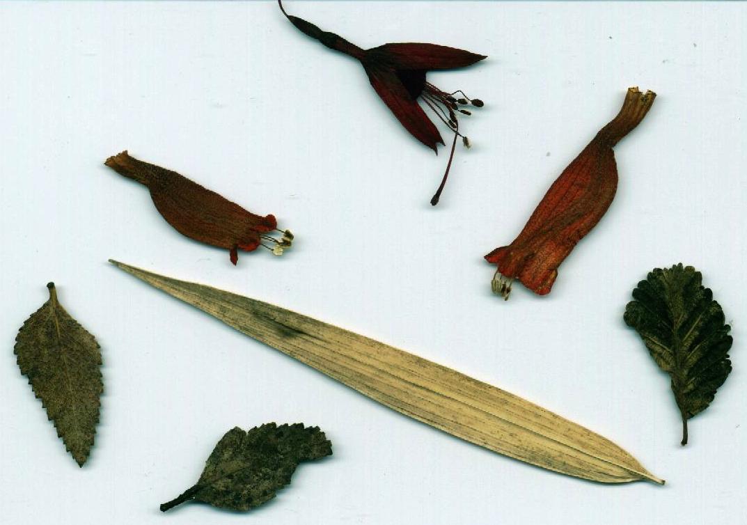 The picture shows some dried leaves that I brought home: quila
(Bamboo) is in the middle bottom, lenga (Southern Beech)to its right, two of the
orange blossoms above and at the very top, a wild fuchsia blossom. I am not sure
about the bottom left leaves: probably cohaique and nirre... Eventually,
the trees thin out, the trail levels and we burst out onto a meadow as level and as
unobstructed as a soccer field. This may be the result of volcanic ash and pumice
accumulating into a terrace, and I am perplexed enough to finish the last remaining
pictures in the camera right here. It's late and we should turn back in ten minutes, so
we'll not be forced to hike the lower trail in the dark.
The picture shows some dried leaves that I brought home: quila
(Bamboo) is in the middle bottom, lenga (Southern Beech)to its right, two of the
orange blossoms above and at the very top, a wild fuchsia blossom. I am not sure
about the bottom left leaves: probably cohaique and nirre... Eventually,
the trees thin out, the trail levels and we burst out onto a meadow as level and as
unobstructed as a soccer field. This may be the result of volcanic ash and pumice
accumulating into a terrace, and I am perplexed enough to finish the last remaining
pictures in the camera right here. It's late and we should turn back in ten minutes, so
we'll not be forced to hike the lower trail in the dark.
Nevertheless, we ignore the time and push on to discover two more such meadows, and
then are overwhelmed when we step out of the forests into the open: we have reached the
tree line and are near a little peak protruding from a rocky wasteland. We have
stepped out into an Andean stage set, with the majestic Volcan Tronador looming
over us in icy grandeur. Werner is off to take pictures of the volcano and I move around
to get a bearing of the other valleys and lakes around us. Maybe we instinctively want to
savor the scene alone; what I feel can best be described as a religious experience...
Lago Frias is partially visible to the left, and, on the plateau that I cross to get a
better view, I find the tracks of some animal with small split hooves. Back, near the
little peak, I take out the binoculars and scan first the valleys, then the blue and white
glaciers of Tronador, and eventually turn my gaze over to the hazy valley in the south. As
I scan back, I notice a bird, soaring in large circles. It is coming towards me, it is
huge and the term airplane comes to mind more readily than bird. When it is close enough,
I can make out it has a white collar and now know for sure it is a condor, a bird I had
known about, but not seen yet on this trip. I do not let it out of my sight: it comes as
close as 100m and I am thankful that I have the binoculars with me. Eventually, the
circles shift to the left and the condor disappears behind the ridges in the north. I am
still under the spell of this experience when Werner comes back. He has also seen the bird
and is just as elated as I am. 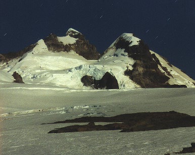
Volcan Tronador (photo from Pablo D. Zavattieri's Gallery)
Now we are eager to return to the valley and we head back down. The descent is uneventful and fast; even the trail in the bamboo is not so difficult to find as we both have learned how to navigate there. The only loser in this event are my legs: I had not bothered to change into long pants before the hike, and thus my shins are covered in cuts, scratches and bruises from the thicket. Marianne wishes she had been able to stay with us on this hike and share in the adventure.
 The next
morning sees us up early as we must catch a boat at the other end of this road, in a spot
called Peulla. As we have camped close to the highest point of the pass, most of today's
cycling is downhill and the challenge is to keep the bike under control on the steep
downward sections. The road has many places with soft gravel and it's similar to the
Carretera Austral, I am told. Werner has no problems with his soft mountain bike tires,
but mine and Marianne's wheels keep slipping into the occasional skid. On two
occasions, buses pass us, its occupants staring from behind dusty glass at us three
cyclists. If I was trekking here, I would not to use the busses at all, just use the
boats, and hike the road. A tent and food would be necessary, but the experience on foot
is so much richer than the bus trip.
The next
morning sees us up early as we must catch a boat at the other end of this road, in a spot
called Peulla. As we have camped close to the highest point of the pass, most of today's
cycling is downhill and the challenge is to keep the bike under control on the steep
downward sections. The road has many places with soft gravel and it's similar to the
Carretera Austral, I am told. Werner has no problems with his soft mountain bike tires,
but mine and Marianne's wheels keep slipping into the occasional skid. On two
occasions, buses pass us, its occupants staring from behind dusty glass at us three
cyclists. If I was trekking here, I would not to use the busses at all, just use the
boats, and hike the road. A tent and food would be necessary, but the experience on foot
is so much richer than the bus trip.
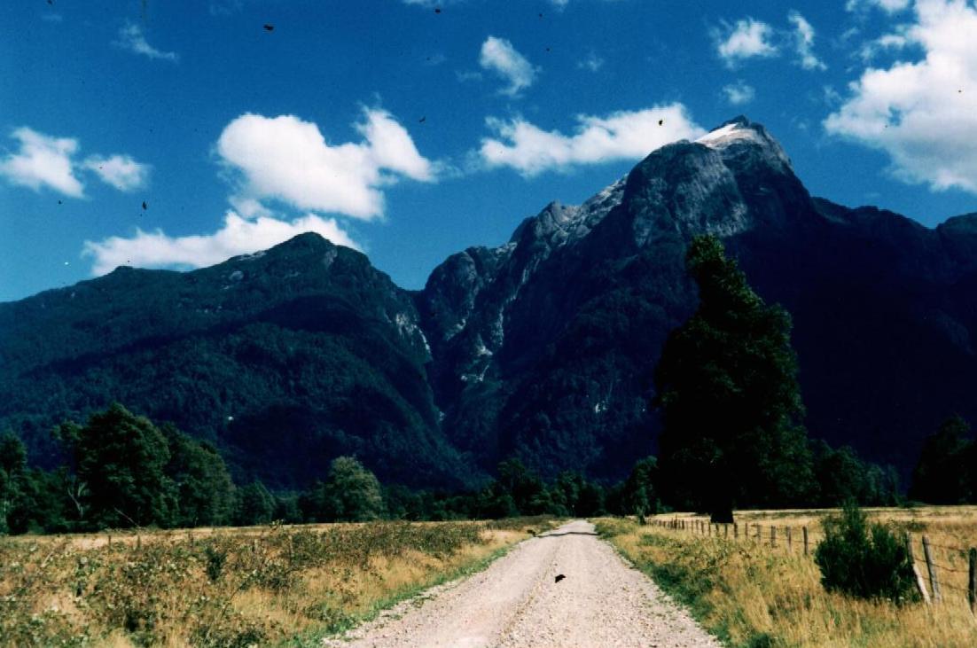
After a 700m descent, the road flattens out and we pedal towards Peulla, where the boat
will leave. We pass several abandoned buildings that, some time ago, served the border
administration, and, around 1 p.m., we arrive at the Chilenean border post. We pass
Immigration and Customs successfully (duties are performed by a friendly couple that
interrupt their house chores to handle this business), but are nearly mired down at the
last check. The two carabineros are bent on finding fault and claim a stamp is
missing in one passport. When we point to the "missing" passport entry, they
switch story and want us go back and repeat the customs inspection. I am annoyed at the
delay and afraid that something might be discovered that could give us grief. Who knows
what an overly zealous official might object to? I talk our way out of it, and insist that
we three put a healthy distance between us and the police stop before we take a break and
discuss what happened.
 In Peulla,
day visitors have arrived and come strolling up the hot and dusty road, and at the pier,
the large catamaran waits for the appointed departure time. We buy tickets, and Werner and
I clamber up a stream bed to wash in the pristine waterfall above it. Back at the boat, we
get impatient as it does not move at the appointed hour. What we do not know at this time
is that Chile had shifted from Daylight Savings to Standard Time over the weekend and thus
our watches are one hour ahead. Eventually, the boat moves out and we cross the large
turquoise Lago Todos los Santos. The mountains rise right out of the lake, and we
pass below the volcano Puntiagudo.
In Peulla,
day visitors have arrived and come strolling up the hot and dusty road, and at the pier,
the large catamaran waits for the appointed departure time. We buy tickets, and Werner and
I clamber up a stream bed to wash in the pristine waterfall above it. Back at the boat, we
get impatient as it does not move at the appointed hour. What we do not know at this time
is that Chile had shifted from Daylight Savings to Standard Time over the weekend and thus
our watches are one hour ahead. Eventually, the boat moves out and we cross the large
turquoise Lago Todos los Santos. The mountains rise right out of the lake, and we
pass below the volcano Puntiagudo.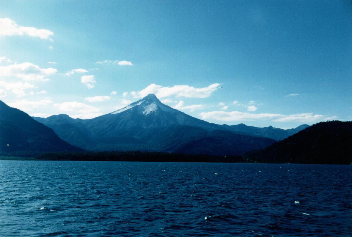 Twice the
boat stops to meet a small craft: it's the end of the summer holidays, and in both cases a
youngster was being rowed from a farm beside the lake to meet the catamaran so he or she
can return to school. The boat arrives a Petrohué, which is just a landing with a huge
hotel. We have gotten the name of a farmer that offers more humble abode, and are being
ferried across the Petrohué river to his small house.
Twice the
boat stops to meet a small craft: it's the end of the summer holidays, and in both cases a
youngster was being rowed from a farm beside the lake to meet the catamaran so he or she
can return to school. The boat arrives a Petrohué, which is just a landing with a huge
hotel. We have gotten the name of a farmer that offers more humble abode, and are being
ferried across the Petrohué river to his small house.
I am afraid I might get fleas from the free-running farm animals and thus take a room.
Marianne and Werner think such danger is more likely to be found in the rooms and they
pitch their tent outside. Whatever is the right decision, I am happy to report that I
picked up no such vermin. In the morning, my companions want to stay behind to spend a few
days hiking near Volcan Osorno and I thus cycle on, alone. The road is paved, but
frequently, long stretches are covered with gray mud. In places, jagged gullies, straight
off the Volcano's cone, meet the road and dump their generous load of ash and dirt. At the
bottom of the valley races the powerful Petrohué river, and in one place tumbles over a
barrier of twisted lave to for its famous falls. But I have my mind set on returning and
am impatient to make distance.
Around noon, I have lunch in Puerto Varas, and then, along a rather monotonous stretch of Routa 5, I cycle into Puerto Montt. The loop has come to a close.